3D Laser Scanning Services
Accurate, non-disruptive on-site capture for buildings of any size - from single-storey retail to multi-level commercial complexes.
What Is 3D Laser Scanning?
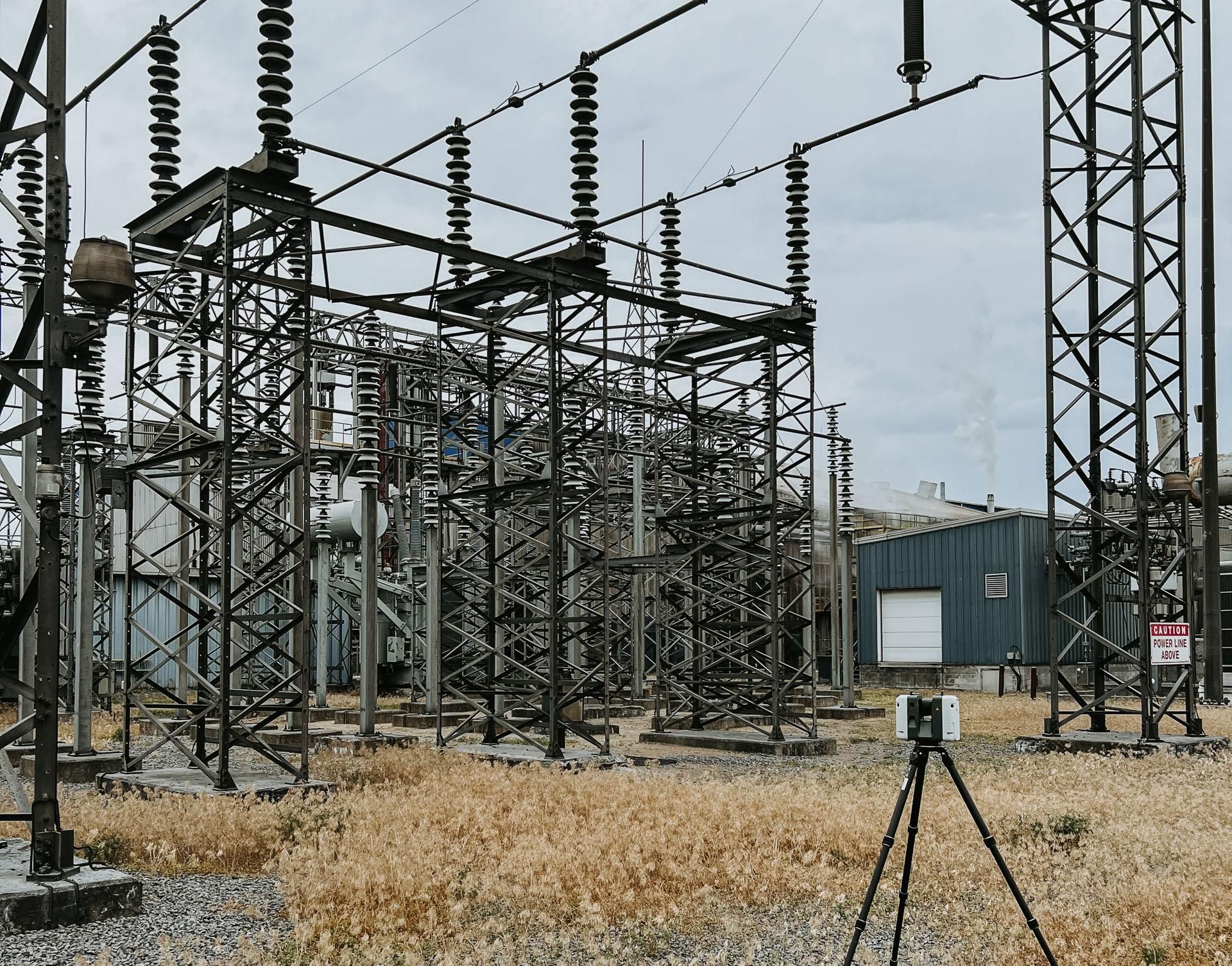
3D laser scanning is a non-contact measurement method that captures the precise geometry of a building's interior and exterior. A terrestrial laser scanner emits rapid pulses of light, measuring the distance to every surface it reaches. The result is a dense collection of three-dimensional measurement points - millions per scan position - that together form a complete spatial record of the existing conditions. For architects, engineers, and contractors working in Ottawa, Toronto, Montreal, and across Canada, laser scanning has become the standard method for producing reliable as built services documentation.
The process is straightforward. A scanner is placed at multiple positions throughout a building, capturing overlapping fields of view from each location. Each scan takes only a few minutes, and the equipment operates quietly without disrupting occupants or ongoing building operations. Once all positions are captured, the individual scans are registered - aligned into a single, unified coordinate system using the overlapping geometry between them. The output is a dimensionally accurate 3D dataset that serves as the foundation for point clouds, BIM models, CAD drawings, and floor plans.
Laser scanning matters because traditional hand measurement cannot match its speed, density, or accuracy at building scale. A single scan position captures geometry that would take hours to measure manually, and the resulting dataset is far more complete. For building documentation services - whether supporting a renovation, a heritage restoration, or a commercial lease - 3D laser scanning provides the verified spatial data that downstream teams depend on. Every deliverable we produce traces back to what was measured on-site, giving your project team confidence in the numbers from day one.
Who Needs 3D Laser Scanning?
Architects & Designers
Accurate existing-conditions documentation before renovation, adaptive reuse, or interior design. Know exactly what you're working with before you start drawing.
Engineers
Precise spatial data for structural, mechanical, and electrical engineering. Measure clearances, verify elevations, and coordinate systems against real geometry - not outdated drawings.
Developers & Property Owners
Reliable building documentation for due diligence, planning applications, and redevelopment. Understand what exists before committing capital.
Contractors
Dependable dimensions before demolition, renovation, or tenant fit-out. Reduce surprises on-site by working from verified scan data instead of assumptions.
How 3D Laser Scanning Works
Site Preparation
We coordinate access, scheduling, and safety requirements with your building manager. Scan day logistics are confirmed in advance so there are no surprises for your team or your tenants.
On-Site Scanning
Our team sets up laser scanners at multiple positions throughout the building. Each scan captures millions of measurement points in minutes. The process is quiet, non-contact, and non-disruptive to building operations.
Data Registration
Individual scans are aligned and registered into a single, unified coordinate system using overlapping geometry. Registration quality is verified against control measurements taken on-site.
Delivery
The registered dataset is delivered in your preferred format, ready for design, analysis, or downstream modelling. A registration report and assumptions log are included with every delivery.
What You Receive
Every 3D laser scanning project produces a registered point cloud - a unified, measurable 3D dataset of your building's existing conditions. From there, the point cloud can serve as the basis for BIM models, CAD drawings, floor plans, elevations, and 3D walkthroughs. You choose the deliverables that match your project needs, and we produce them from the same verified scan data.