Registered Point Cloud Services
Precise, unified point cloud data delivered in the format your team needs.
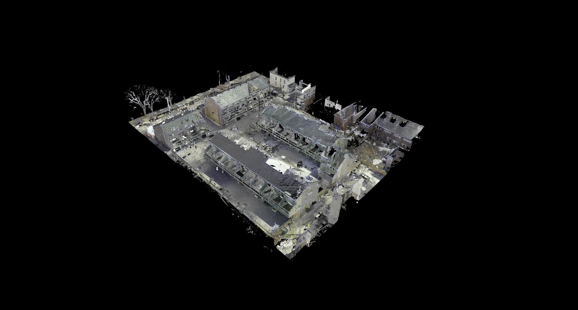
What Are Registered Point Clouds?
A registered point cloud is the result of aligning and merging multiple laser scan positions into a single, unified three-dimensional dataset. Each scan captures millions of precise measurement points, and registration brings them together into one coordinate system so your team can work with the building as a complete, accurate digital record.
Point cloud services are the foundation of every downstream deliverable we produce. Whether your project requires BIM modelling, CAD drafting, or spatial analysis, the registered point cloud is the verified source data. We deliver point cloud data to architecture, engineering, and construction teams across Ottawa, Toronto, Montreal, and throughout Canada.
Our laser scan data undergoes rigorous registration and quality assurance before delivery. The result is a clean, navigable dataset that integrates directly into your preferred design software, ready for measurement, modelling, or coordination.
Who Needs Point Cloud Services?
Architects
Use registered point clouds as a precise existing-conditions reference for renovation design, heritage documentation, and space planning. Import scan data directly into your design environment for accurate overlays.
Engineers
Structural, mechanical, and civil engineers rely on point cloud data for clash detection, clearance verification, and infrastructure assessment. Accurate spatial data eliminates guesswork on complex retrofit projects.
BIM Teams
Registered point clouds are the starting point for scan-to-BIM workflows. A properly aligned dataset accelerates modelling and ensures your BIM deliverables match real-world conditions from the outset.
Facility Managers
Maintain a comprehensive digital record of your building for maintenance planning, tenant improvements, and capital project scoping. Point cloud archives reduce the need for repeated site visits.
Our Point Cloud Registration Process
Data Import
Raw scan files from the field are imported into our processing environment. We verify file integrity, confirm scan coverage, and catalogue each position against the project scope.
Alignment & Registration
Individual scans are aligned using a combination of target-based and cloud-to-cloud registration methods. We unify all positions into a single coordinate system with verified accuracy tolerances.
Quality Check
Every registered dataset undergoes a full quality audit. We check registration error reports, verify scan overlap, and clean noise or artefacts to ensure the final point cloud meets project standards.
Format Export & Delivery
The completed point cloud is exported in your required formats and delivered via secure file transfer. We provide project documentation including registration reports and coordinate references.
What You Receive
Every registered point cloud delivery includes a clean, verified dataset ready for immediate use in your design and analysis software. We export to the formats your team works with.
All registered point clouds are delivered with documented accuracy metrics. Typical registration accuracy falls within 2-4 mm between scan positions, depending on project conditions and scope.
Deliverables include the registered point cloud files, a registration summary report, and coordinate system documentation. Large datasets are segmented by floor or zone for efficient handling in your software.